

This research line consists on the proposal of a Privacy Risk Score (PRS) based on an estimation of the potential audience that may be see a sharing information action. We consider a friendship layered model that provides information about the reachability of a user sharing action based on the distance between the user and the potential audience. PRS integrates intra and interpersonal factors as well as user’s privacy policy and information about diffusion process in the social network.
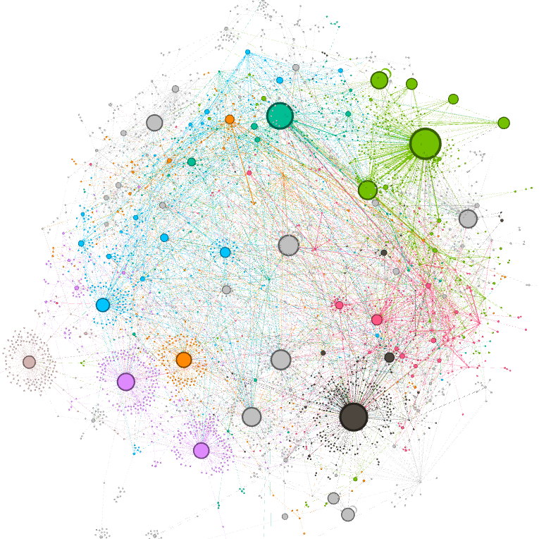
We analyze the evolution of user interactions that take place in television, socio-political, conference, and keynote events on Twitter. Interactions have been modeled as networks that are annotated with the time markers. I study changes in the structural properties at both the network level and the node level in order to detected interaction patterns during events in social networks and be able to predict future behaviors.

This research topic consists on the application of artificial intelligence techniques such as coalition structure generation, Bayesian learning, and Belbin’s role theory to facilitate the generation of working groups in an educational context. We have already developed a tool that improves current state of the art proposals in three ways: i) it takes into account the feedback of other teammates in order to establish the most predominant role of a student instead of self-perception questionnaires; ii) it handles uncertainty with regard to each student’s predominant team role; iii) it is iterative since it considers information from several interactions in order to improve the estimation of role assignments. We tested the performance of the proposed tool in an experiment involving students that took part in three different team activities. The experiments suggest that the proposed tool is able to improve different teamwork aspects such as team dynamics and student satisfaction.
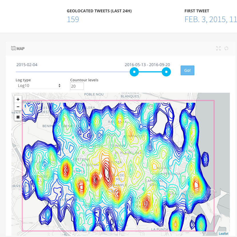
We are working on a model for pedestrian-movement prediction based on the users’ geo-tagged activity in Twitter. The model is based on a real-time gravitational contour map that shows the mobility trends of users in a city. The model is able to optimize the individual walking route following two criteria: avoiding crowds or considering the points of interest (PoIs) of the city.